
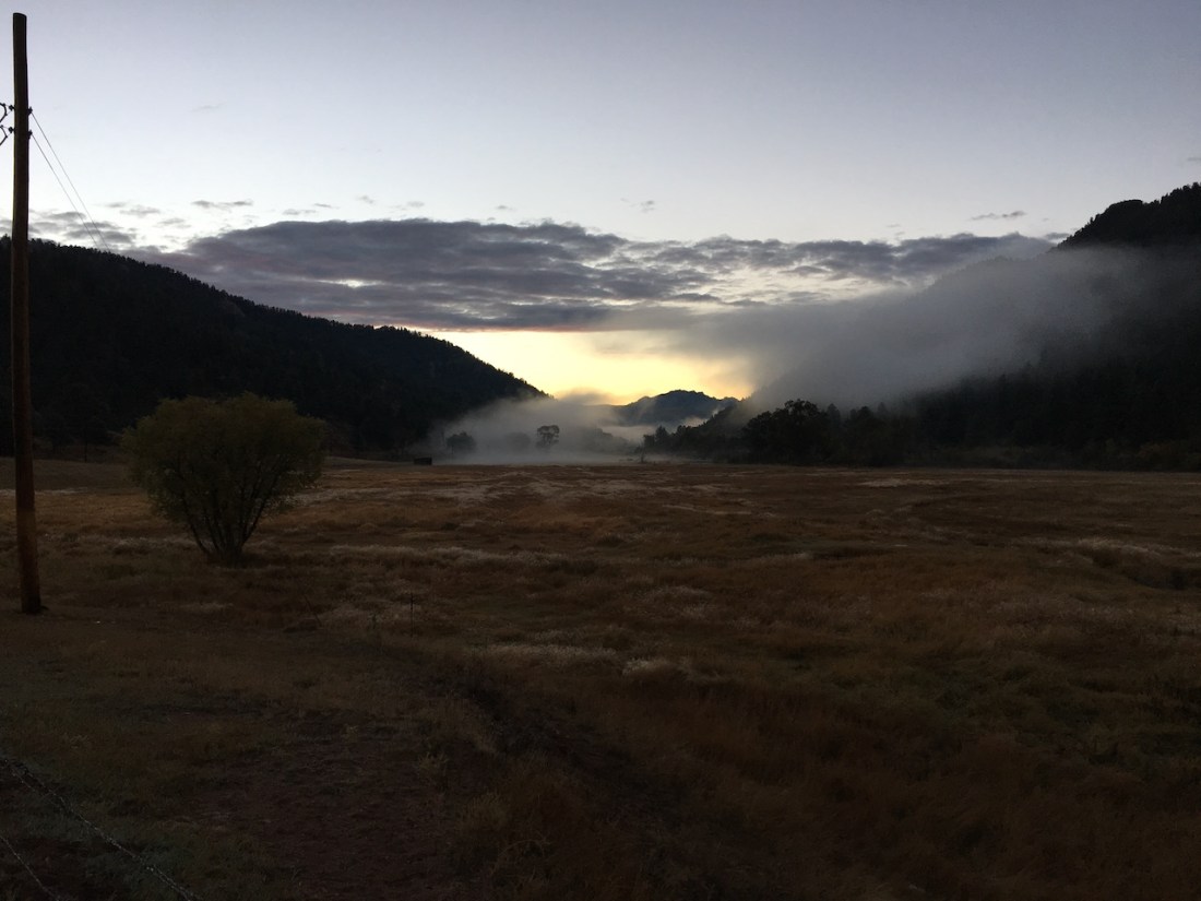
Cold. That is what sticks in my mind the most. Until that first climb. Then, cold becomes back breaking heat. What am I talking about? One of my favorite mountain bike rides, Buffalo Creek.
My friend and I usually start from the parking lot at Pine Valley Ranch. The paved lot is a decent size and the bathrooms are nice, from a mountain park point of view.
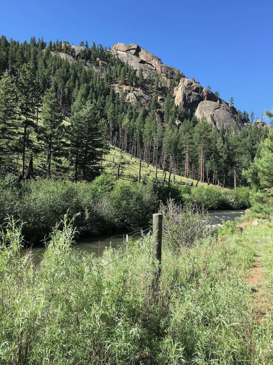
Speaking of views, this is a stunning area, rock cliffs and steep hills ascend from the bank of the north fork of the South Platte River, Pine lake is just a short walk away and there is a nice picnic area between the parking lot and the river. Tall pines abound along with the occasional aspen trees.
This isn’t our destination though, this is our starting point. We get on our mountain bikes and ride to the west end of the parking lot. There we meet a wide, crushed granite trail that parallels the river. We follow this trail for only a short distance, then turn left and cross a bridge over the river. This is the start of the Buck Gulch trail and the start of several miles of up.
The trail quickly enters a valley and starts up hill. The first obstacle, right at the bottom of the valley, is a rock face that is steep and crosses the complete trail. It is rough and there are only one or two good lines to go up it without spinning out on loose gravel or the rock itself. The left side is usually the side we try. It is a short but steep, maybe 15 feet or so. The problem is, we aren’t warmed up yet. I make it half the time, maybe, without having to get off and walk.
After this obstacle, we have a steady, gradual climb, maybe a quarter mile or so, to a fork in the trail. The left fork is Strawberry Jack trail while Buck Gulch continues straight. This is a loop ride so we go up one side and come back down the other.
An interesting side story here. We always used to go up Strawberry because we thought it was easier than Buck. Both get steep quickly, however they did some trail rerouting on Buck a few years back and while it may not be easier, you do get a few breaks between the really steep sections. We usually take Buck now.
Right after the fork, there is a switchback and then the trail really starts to climb. Not too crazy at first until we get to the “corner”. This is a very steep section of the trail that is a left hand, uphill turn, usually a bit rutted, and always full of loose crushed granite. Not fun going up or down. We usually stop and catch our breath before we tackle it and sometimes rest again after we get through it.
The next section is probably the steepest sustained climb of the entire ride. We go in and out of forest through this section after having been in forest most of the way. The “fun” part about this section are a few, short, extra steep climbs. Do you see the theme for this part of the trail yet?
Anyway, the trail does eventually level out some through the new areas. There is even some granite slick rock to negotiate! We finally reach the end of the first ascent after three miles and 1100 feet or so of climbing.
We usually will stop at this point, near a small, remote parking lot that has several signs with information about the area. If it is a cold morning (usually) we will peel off a few layers here, as we are warm now, and discuss the ride up to this point. How hard or easy it went along with any interesting sections. We also usually down a few bites of an energy bar and maybe take a bathroom break (trees are abundant) and then we are ready to tackle the next section, which is named Skipper. It starts flat followed by a gradual downhill through the thinning forest.
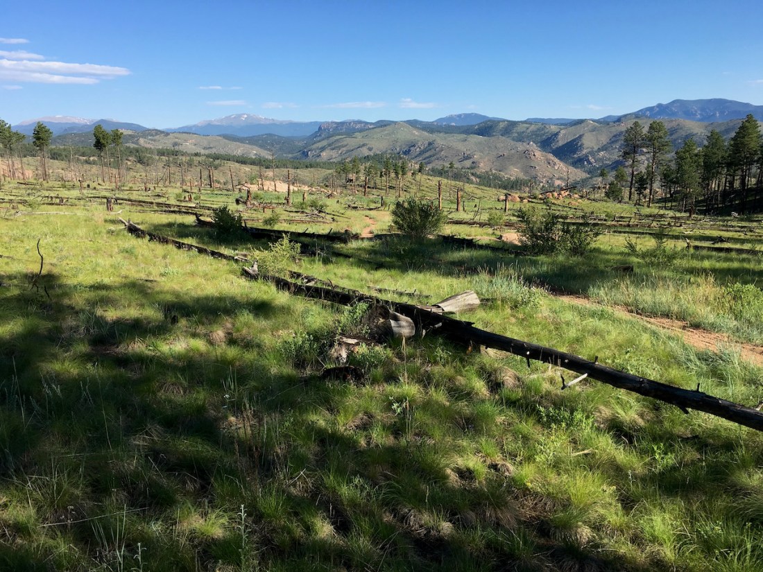
A side note on this next section of trail. We will be briefly entering a burn area from one of the largest forest fires the state has seen (until 2020). It has been over 15 years since the fires so life has returned to the area. It has become open meadows with new trees, both conifer and Aspen poking up here and there.
Mother Nature has also seen fit to continue to modify the area. There has been several very high wind storms which has caused many uprooted trees, especially as we descend into Beaver Gulch. What’s interesting about this is the trees that have fallen are in the middle of the forest, not near the edges. A number of them have fallen across the trail. These trees have either been moved, cut or there are new trails around them.
Skipper trail offers a little bit of everything. First is the slight decline through the woods then the open burn area. Here we make a 90 degree turn followed by a steeper drop through several more turns then it is back into the woods. A thicker forest this time. The trees close in around us as we finally meet Beaver Gulch. It is tricky through this section, a steep down, a sharp right turn through the creek, another sharp right turn with a steep uphill with several more turns. It takes the right line, speed and gear ratio to get through this section successfully. The trail continues to climb quickly through several more interesting sections filled with loose rock, tree roots and sharp turns.
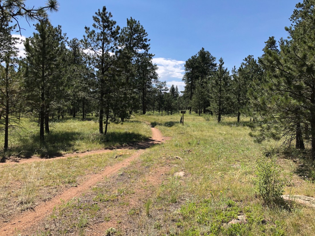
Now, the woods start to open up and the trail flattens out until we are winding through an open forest of Ponderosa Pines. This is one of my favorite sections of any ride I’ve done. I could sit and enjoy this area for a long time. There is very little undergrowth between the trees. Mostly native grasses, granite rocks and boulders, some the size of small houses and, if we are lucky, wild flowers.
As I’m taking all this in, we come to the next trail intersection. Here we meet Strawberry Jack trail and make a right. This trail is double track vs. single track, basically an old forest service road.
We slowly ascend this trail for the next mile or so. It crests at the intersection of Charles Cutoff. We will take this trail on our way back, but for now we continue straight through a short downhill section, full of deep sand. Here we meet Miller Gulch trail and make a right.
Again, Miller Gulch is a forest service road. The forest service recut this trail this past summer (2020), probably due to all the forest fires in the state. It made it a bit soft in places due to the fresh dirt.
We meander through the same forest we’ve been in since Skipper trail. Slight ups and downs, past an intersection on the left for Gashouse Gulch trail and continuing on for another half mile until we get to some huge boulders and another trail / fire road intersection, again on the left.
This is also Gashouse Gulch trail, more or less. Basically the trails in this area all interconnect forming a large triangle. We take the route we do as it gives us a little more mileage and it isn’t as busy.
We continue to follow Gashouse until it intersects Baldy and the actual Gashouse Gulch trail (single track). This completes the triangle. From here we have two choices, go down Baldy and come back Gashouse or go down Gashouse and come back Baldy.
I guess there are several more choices, go down and back on Gashouse or do the same on Baldy. No matter what, we will end up back at this same intersection of trails. For this ride, we’ll go down Gashouse and come back up Baldy.
Gashouse is flat for a bit, then descends slightly, then proceeds uphill slightly. Then we reach the rock garden, as I call it. This fairly short section winds through the most rocks we will see. These are all smaller (mostly) rocks, lots of them sharp, that you have to go through or around or over. Momentum is your friend here, just not too much momentum.
After the rock garden the trail descends for quite some time. We wind through pine forest as well as sections of Aspen trees (beautiful in the fall) There are a few switchbacks but nothing too difficult until we make a left around one of the last switch backs. This is followed quickly by a 90 degree right turn through a rocky, section that is basically a little stream. Then a slight hill with a hard right turn and several tight downhill switchbacks.
The downhill switchbacks are a fairly recent trail modification. Before they were constructed we had to carry our bikes over several very large boulders. One time, coming up the trail, I slipped on one of the boulders and fell off of it, landing on my back with my bike landing on top of me. My water bladder saved me from getting really hurt. I didn’t realize it for another mile or so of riding, but the derailleur hanger had cracked during the fall. It finally broke and we tried several things to get the bike into “single speed” mode but they all failed so I ended up walking / coasting the bike back to the parking lot.
After the tight switchbacks, we have a bit more pine / aspen forest downhill. We finally intersect Redskin trail. It goes to the right while Gashouse goes to the left. The trails meet by another small, remote parking lot. When we come up Gashouse, we use this place as a rest area but since we are going down, we only stop if we need a bathroom break.
The trail flattens out for a bit as the trees start to thin out. This part of the forest is mainly Ponderosa Pines. The trail curves to the right as we exit the forest and enter the largest burn area we will pass through. The area has grown back into a beautiful meadow with young trees growing here and there. This section is about a mile long, all downhill with only a small, technical section of granite early in the descent. My friend always seems to “clean” this section but I always have issues with it, going up or down. After the granite, there are long straights, a few turns, some sandy sections but nothing difficult other than keeping your eye on the trail as the views are simply stunning through here. One of our favorite sections of the ride although it can get hot in the summer when we go up it.
All too soon this section ends and we enter the woods again and immediately intersect the bottom of Baldy, well almost the bottom. We won’t do the short section of Baldy that leads down to road 543. Instead, we will head up Baldy to where it intersects with Gashouse again.
The trail quickly leaves the woods. This lower section has many small ups and downs mixed in with twists and turns through little gullies, as it works its way slowly uphill to the bottom of a draw. This is where the old trail stops and we make a right onto the new trail.
Before the trail updates, Baldy basically followed a dry stream bed up this draw. It was very sandy in spots and was an unrelenting, mostly straight, uphill grind. Now the trail winds up the side of the draw, and slowly works its way through woods and boulders, occasionally intersecting the old trail, only to meander off again. Still a tough climb but much less so than before. Plus, the trail is much more interesting to ride now.
About a quarter mile from the top, we have to cross a large granite slab. It has a short, steep entrance followed by a left across the granite and then back onto the trail. Great views here!
The last part of the climb to the top gets steeper and steeper until the crazy left just before the top. At the top, the path goes between several large granite boulders with a few trees mixed in. We generally just ride through this section, rather than rest, as the trail starts a gentle downhill followed by a gentle uphill that finally flattens out before intersecting Gashouse.
We proceed through this intersection and head back down the fire road that we were on before. After finally stopping for a rest and a snack by the big boulders where the fire roads meet, we head back up Miller Gulch, make a left onto Strawberry Jack, climb the short sandy hill and make a right onto Charles Cutoff.
This is probably the most fun and most technical trail of the ride. Almost all downhill, the trail is filled with granite slabs and boulders that all have to be crossed. Lots of potential to go over your handlebars if you aren’t careful and keep your weight well back on your bike. My friend and I both ride hard tails so we aren’t as fast through here as a lot of folks that ride full suspension bikes. Still, we cover this section at a pretty good clip!
It ends all too soon when we have to make a left onto Homestead trail. Homestead is a pretty trail that goes in and out of the trees. There is a large granite spine off to the right that we will follow for a ways.
We usually stop just before a long downhill and grab a final snack. After that downhill there is one last fairly steep uphill with a switchback at the top. Then another down and up and we are back at Strawberry Jack! We make a right onto Strawberry Jack rather than crossing it and going back down Skipper, which is the way we came up several hours ago.
From this point, it is mostly downhill back to the parking lot. We continue though the woods and shortly come out into another burn area winding our way down to a short rocky ridge.
Side note (again). This section is also a newer part of trail. It used to be another straight up, or down, section along an old fire road. The new and old trail pass by a large round water tub that horses and other animals use. When we ride up this section, we always stop here and rest for a bit and eat a snack. There is a small grove of Aspen trees nearby that are always something to see in the fall with their bright orange and gold leaves.
At the end of the ridge the trail makes a downhill switchback followed by a tricky rock and boulder section then another ninety degree turn. From there, it is downhill for a bit as we renter the woods and negotiate a narrow section of newer trail that contains a couple of loose switchbacks before it joins the old trail again. A little more downhill and then we have a bit of climbing to reach the final crest of the trail. From here, it is a long downhill along the side of a hill until we reach a hard right turn and enter the first valley we ascended. A little farther and we connect with Buck Gulch again. We follow that down to the river, cross the bridge, make a right and continue the short distance back to the parking lot and our cars. Ride complete!
In all we’ve gone over 21 miles in a little over 2 and a half hours. We’ve climbed over 2600 feet and descended the same. We started out freezing and now we are hot and tired. Time to talk and unwind a bit, share stories of the ride just completed, soak up some sun and enjoy a journey completed with great friends in a beautiful place named Buffalo Creek.
I’ve added a number of links below that will provide more information on the area.
Finally, this is one of the best videos I’ve seen that really describes what mountain biking is, at least to me.
Links:

Excellent description! One of my favorite rides. There is always something to make it a fun adventure. Especially when you have a fun riding friend.
LikeLiked by 1 person
What a beautiful description of what sounds like an amazing ride! Reading it made me feel as if I was on the trail myself, taking in the gorgeous sights! I can see now why you both love riding your bikes there!
LikeLiked by 1 person